Skip to main content Skip to footer

Hiking

Explore Wawa on Foot: Unforgettable Hiking Adventures Await

Wawa, Ontario, is a true northern gem for outdoor enthusiasts, offering breathtaking hiking opportunities for every level of adventurer. From rugged Lake Superior coastlines to peaceful inland trails, the Wawa area is surrounded by pristine wilderness, scenic vistas, and rich natural beauty that’s just waiting to be explored. If your interest is in scenery, waterfalls, flora and fauna, history, or our many local gems, there are plenty of possibilities for day trippers, backpackers and the winter enthusiasts.

Plan Your Hiking Adventure

Whether you're here for a weekend or a full northern getaway, Wawa’s trail network is the perfect way to connect with nature. Don’t forget to bring your camera, wear sturdy footwear, and pack plenty of water and snacks. Trail maps and local advice are available at the Wawa Visitor Information Centre—look for the iconic Wawa Goose!

Visiting in the off-season? (October – May) Visit the Michipicoten Memorial Community Centre located at 3 Chris Simon Drive and friendly staff will assist you in planning your next hike.

Voyageur Trail Association

Many local trails are maintained by the local volunteer group whose vision is to work with volunteers and partner organizations to build a continuous wilderness-style hiking trail from Sudbury through Sault Ste. Marie to Thunder Bay, a distance of some 1,100 km paralleling the rugged Northern Ontario shores of Lake Huron and Lake Superior.

Read more about the association on their website www.voyageurtrail.ca

Trails in and Around Wawa

Whether you’re looking for a short nature walk or a full-day backcountry experience, Wawa’s local trails deliver unforgettable experiences just minutes from town:

  • Magpie High Falls to Silver Falls Trail
    A local favourite, this easy-to-access trail leads to the stunning Magpie High Falls. Feel the spray of the falls from the viewing platform and enjoy the peaceful forest surroundings along the way.
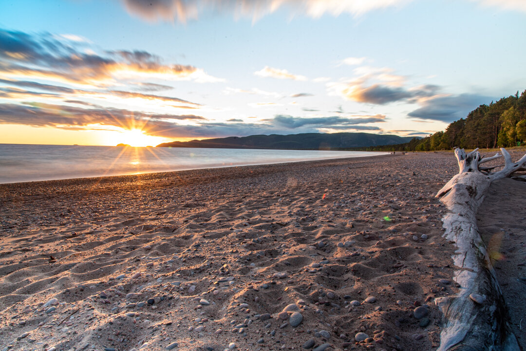
  • Wawa Waterfront Trail
    Enjoy a relaxed stroll on the boardwalk along the shoreline of Wawa Lake. This trail is ideal for families and visitors who want a casual walk with access to picnic areas, beaches, and interpretive signs that tell the story of the region.

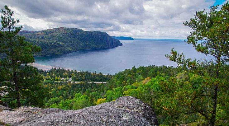
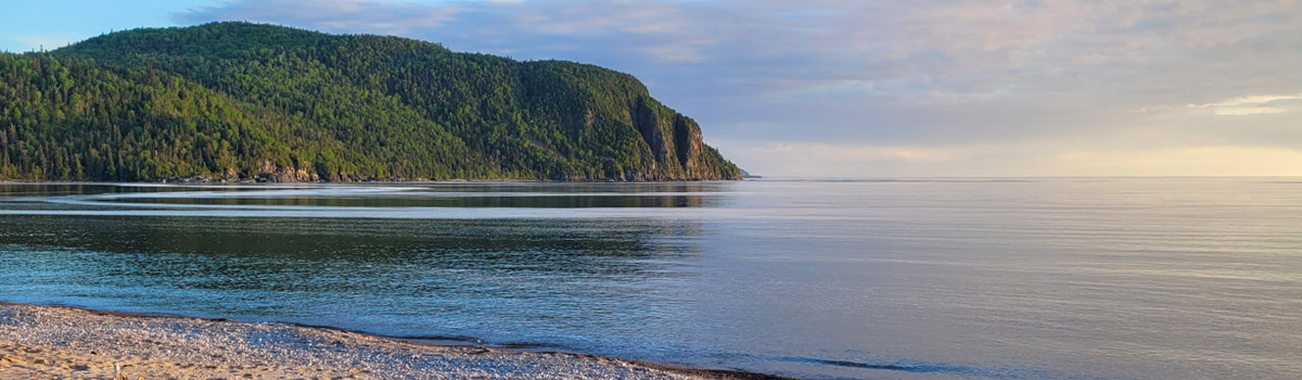
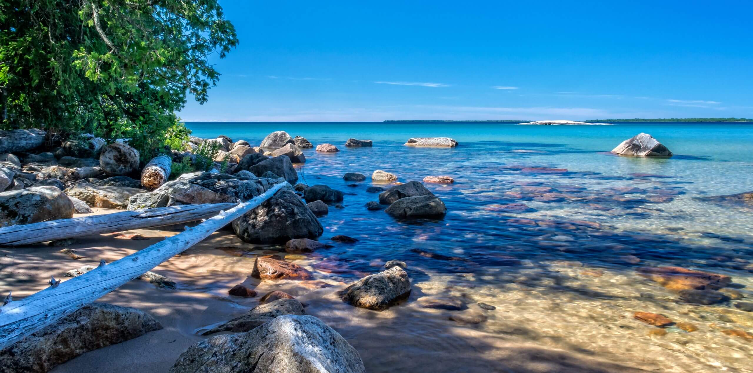
Lake Superior Provincial Park: A Hiker’s Paradise

Just south of Wawa lies Lake Superior Provincial Park, one of Ontario’s premier destinations for hiking. This vast protected area features over 150 km of trails that wind through ancient forests, over rocky ridges, and along some of the most spectacular shoreline in Canada.

Lake Superior Provincial Park hosts 11 dedicated trails that let visitors explore the variety of landscapes that draw people back year after year.

Check out the Ontario Parks website for more information:  

https://www.ontarioparks.ca/park/lakesuperior

Ready to hit the trails? Explore quick highlights of Lake Superior Park’s stunning hikes below:

Pictograph

Generations of Ojibwe recorded their dreams and spirits in red ochre paintings at this sacred site. The trail is short, but rugged, descending through rock chasms and broken boulders.

The Pictographs are accessed from a rock ledge at the edge of Lake Superior and can only be viewed when the lake is calm. The site is open from mid-May to mid-September. Caution is advised when venturing onto this rock ledge due to its slope and the unpredictable nature of Lake Superior and its wave action. 

To learn more about this sacred site, check out this article from Northern Ontario Travel.

Moderate; 0.5 km (0.3 mi) loop; .1/2 - 1 hour

Climb the Awausee for a bird’s-eye view of the Agawa Valley and Lake Superior. This demanding trail starts at the base of Agawa Mountain and follows an old logging road before veering uphill along a ravine. The first lookout (45 min return hike) offers a view of the lower Agawa River Valley and Agawa Mountain.

Continue climbing through maple forests to a series of lookouts, 200 metres (650 ft.) above the Agawa Valley. Descend along the creek to join up with the old logging road and back to the trail’s beginning.

Awausee (Hwy km 1101.4)
Demanding; 10 km (6.2) loop; 4 - 6 hours
To the first lookout and return is 45 minutes

Beginning at Crescent Lake Campground the trail takes you through a forest of Yellow Birch which is at least 80 years old and century old pines. You’ll pass by Crescent, MacGregor and Mudhole Lakes, part of the Crescent Lake Canoe Route. This is an ideal hike for families and nature enthusiasts.

Easy; 2 km (1.2 mi) loop; 1/2 - 1 hour


Coastal Trail

Several access points make it possible to spend one or several days hiking the Coastal Trail. Access points are located at: Agawa Bay, Sinclair Cove, Katherine Cove, Coldwater River, Orphan Lake Trail and Gargantua Road. The Park Map is recommended for those hiking the coast.

The most challenging and demanding trail in the park, the Coastal Trail takes you along the high cliffs and rocky beaches of Lake Superior. The trail extends from Agawa Bay to Chalfant Cove.

The trail ascends and descends over cliffs and rocky outcrops and crosses beaches of boulders and driftwood. Use extreme caution when hiking this difficult terrain. The rocks can be very slippery, especially when wet with dew, fog or rain. Windblown trees may obstruct the trail. 

Blue, diamond-shaped symbols mark where the trail enters forested areas. Rock cairns mark exposed sections. Generally, the trail hugs the coastline. If you lose the trail, continue along the shore and eventually you will find the trail again.

Gargantua is the main access point for the Coastal Trail. The 14 km (8.7 mi) gravel road from Highway 17 to the parking lot at Lake Superior is rough so allow 45 minutes.

Very Demanding; 65 km (40 mi) linear; 5 - 7 days (entire trail)

Gargantua is the main access point for the Coastal Trail of Lake Superior Provincial Park. It is an easy 3 km walk down an old road from the parking area to Gargantua Harbour.

You can continue hiking from Gargantua Bay all the way to Chalfant Cove–the most northern point of the Lake Superior Provincial Park Coastal Trail. Gargantua Harbour itself is such an interesting location, it makes a great day hike on its own. There is a ghost town, shipwrecks, campsites, good swimming, and a lookout over Lake Superior toward Warp Bay. Gargantua Harbour is a natural harbour that became a fishing and logging village that was at its peak in the 1930s and 40s. The only access back then was by a boat that brought supplies several times a year. Looking out over the bay at Gargantua Harbour, you can see the remains of a sunken boat named “The Columbus”. In the early 1900s, the 130 ft. fishing boat caught fire while at the docks, and it was cut free to burn and sink to save the docks and town from burning as well. You can still see the boiler sticking out of the water in the bay on calm water days.

South of Gargantua, the Coastal Trail is extremely rugged and very demanding. Between Gargantua and Rhyolite Cove the trail climbs over 80 metres (260 ft.) to spectacular vistas over the lake.

The park’s geology is most dramatic on the coast where waves have exposed the rock shoreline. Rhyolite and Beatty Coves are particularly interesting. Along the way, sand and cobble beaches are nestled in coves, providing shelter for campsites.

Gargantua North:
Gargantua to Warp Bay: Easy; 5 km (3.1 mi) 
Warp Bay to Devil’s Chair: Easy; 2 km (1.2 mi)
Gargantua to Chalfant Cove: Moderate; 7 km (4.3 mi)

(Note: the above distances are one-way only; return along the same routes to Gargantua Harbour.)

Gargantua South: Very Demanding
Gargantua to Orphan Lake Trail: 20 km (12.4 mi)
Orphan Lake to Katherine Cove: 11 km (6.8 mi)
Katherine Cove to Sinclair Cove: 14 km (8.7 mi)
Sinclair Cove to Agawa Bay: 10 km (6.2 mi)

All trail information source: Lake Superior Provincial Park 

The Nokomis Trail sits just inland from Old Woman Bay in the northern limits of Lake Superior Provincial Park. Providing a wonderful introduction to the boreal forest environment which dominates from this point north, the trail also offers wonderful southern vistas of the surrounding forested hills and stunning Old Woman Bay to the west.
Access the trail from the Old Woman Bay Day-Use area. Climb through the lichen-draped boreal forest to scenic lookouts. You may be able to see the face of an old woman immortalized in the cliff, rising 200 metres (650 ft.) above Lake Superior. 

The Nokomis Trail is ranked among the top five-day hikes in the country, according to Lonely Planet’s “Discover Canada” guidebook.”

Moderate; 5.0 km (the trail's ascent and descent are steep) 

This diverse trail passes through hardwood and evergreen forests, including an area burned in May 1998. Near the end of the burn there is a side trail (linear) climbing to spectacular lookouts over Lake Superior.

A pebble beach on Lake Superior marks the half-way point, where there is a junction with the Coastal Trail. To complete the Orphan Lake Trail, follow the Baldhead River upstream, past the waterfalls. The trail then climbs to the east shore of Orphan Lake before joining with the trail back to the trailhead.

Moderate; 8 km (5 mi) loop; 2- 4 hours

Access the trail from Rabbit Blanket Lake Campground, near campsite #30. An alternate access point is located near campsite #49.

Climb 150 metres (500 ft.) through a mixed forest to the top of Peat Mountain, overlooking ridges and valleys formed by glacial activity. On a clear day you can see Michipicoten Island, 55 km (34 mi) to the west, out in Lake Superior.

There is a side loop to the Foam Lake Lookout, a 45-minute return hike, or stay on the main trail descending to Foam Lake. There is one backcountry campsite at Foam Lake.

Demanding; 11 km (6.8 mi) loop; 3 - 5 hours 

Pinguisibi is the Ojibwe name for “river of fine white sand”. This river is an ancient travel route used by the Ojibwe as they hunted, fished and trapped northwards into the interior.

The first waterfall is a short hike upstream. The trail continues along the Sand River, past two more waterfalls, rapids and quiet sections of the river. The trail ends near portage 28 of the Sand River Canoe Route. Return along the same route.

Easy; 6 km (3.7 mi) return, linear trail; 1½ - 3 hrs

Access the trail from Rabbit Blanket Lake Campground. While much of the trail is easy, there are sections of uneven footing and some rock hopping to cross the river. A variety of ferns and moisture-loving plants grow on the cool damp forest floor along the river.

Moderate; 2.5 km (1.5 mi) loop; 1- 2 hours

At the turn of the century, visitors were often guided by Towabanasay (Tow-a-ban-a-say), often called Towab, an Ojibwe guide who held the hunting rights to a 1,300 square kilometre area which included the Agawa River.

The trailhead is located 3.5 km (2 mi) along the Frater Road. The hike to Agawa Falls and return is recommended as an overnight trip. There are several campsites along the way. Much of the trail is alongside the river, however there are several steep ascents and descents. Shorter hikes can be taken to Burnt Rock Pool (moderate; 2 - 4 hours return) or further upstream; retrace your steps to return.

The trail ends at Agawa Falls, one of the highest waterfalls in the park (25 metres; 82 ft.)

Very Demanding; 24 km (15 mi) return, linear; 8 - 14 hours 

Following the shoreline of Rustle Lake, the trail includes two viewing platforms and a floating boardwalk, where you can watch for wetland wildlife such as beaver, otter, marten, Great Blue Heron, and moose.

Easy; 1.5 km (1 mi) loop; 45 min. – 1.5 hours

Sign up to our News Page

Stay up to date on Wawa's activities, events, programs and operations by subscribing to our News page.

This website uses cookies to enhance usability and provide you with a more personal experience. By using this website, you agree to our use of cookies as explained in our Privacy Policy.